Geospatial Mapping

Projects

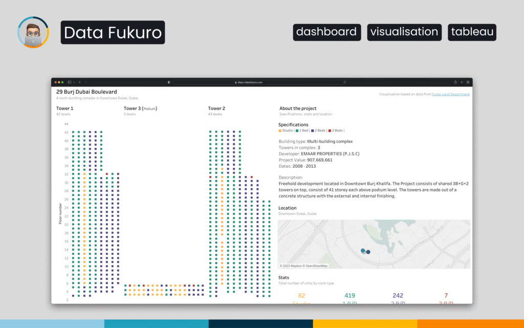
Real-Estate Visualization: Apartment Distribution in 29 BLVD Towers

This Tableau dashboard visualizes the 29 BLVD residential complex in Downtown Dubai using a floor-by-floor building layout. Each unit is represented as a coloured square mapped to its exact position within the towers. Users can explore apartment types, specifications and project details interactively, along with a geospatial view of the building’s location.

Projects

Dubai Rental Insights: Tableau Visualization

This Tableau dashboard visualizes rental market data from Dubai’s Downtown and DIFC districts. Users can explore prices by room type, compare median rents, view feature-driven price differences and analyze spatial patterns across major towers. The tool provides a clear, interactive overview of the rental landscape and supports smarter property research.

Scroll to Top